19 Upland Dr Laconia, NH 03249-6778
Visit 19 Upland Dr in Laconia, NH, 03249-6778
This profile includes property assessor report information, real estate records and a complete residency history.
We have include the current owner’s name and phone number to help you find the right person and learn more.
Sold Mar 2024
$567,500
Market Activities
Jan 2024 - Mar 2024
Jan 2024 - Mar 2024
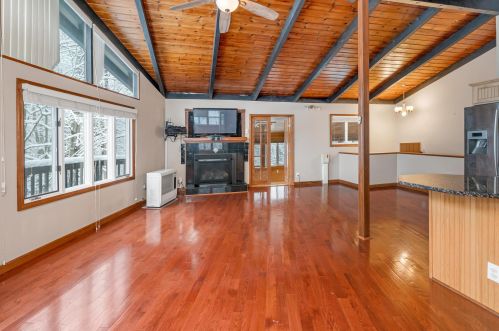
PROPERTY OVERVIEW
Type: Single Family Residential
4 beds2 bathsLot: 0.85 acres
4 beds2 bathsLot: 0.85 acres
Facts
Built in 1978Stories: 2 story with basement Lot size: 0.85 acresStyle: Cottage Building: 1Exterior walls: Wood Rooms: 7Basement: Full Basement Bedrooms: 4Heat type: Forced air unit
Features
Fireplace
Listing info
Last sold: May 2014 for $226,200
Other details
Units: 2
Recent residents
| Resident Name | Phone | More Info |
|---|---|---|
| Linda M Bolduc | (603) 293-2076 | Status: Renter Occupation: Administrative Support Occupations, Including Clerical Occupations Education: Graduate or professional degree |
| Dan S Conger, age 59 | (603) 293-2076 | |
| Daniel S Conger, age 59 | (603) 293-2076 | |
| Linda M Conger, age 55 | (603) 293-2076 | Status: Homeowner Occupation: Executive, Administrative, and Managerial Occupations Education: High school graduate or higher |
| T Powers | (603) 293-2076 | |
| Katie Boyd | (603) 293-2167 | |
| Danny Conger | Status: Homeowner Occupation: Executive, Administrative, and Managerial Occupations Education: High school graduate or higher Email: |
|
| Janet F Geraci, age 69 | (603) 293-0759 | Occupation: Self employed Education: Graduate or professional degree |
| Todd A Powers, age 53 | (603) 293-7276 | |
| Charles B Tisch, age 47 | ||
| Ann M Twombly, age 77 | (603) 293-0018 |
Business records related to this address
| Organization | Phone | More Info |
|---|---|---|
| Fortress Enterprise North, LLC | Business type: Limited Liability Company - Domestic |
Neighbors
14 Upland Dr
N E Gile
N E Gile
Real estate transaction history
| Date | Event | Price | Source | Agents |
|---|---|---|---|---|
| 05/05/2014 | Sold | $226,200 | Public records | |
| 07/24/2007 | Sold | $100,000 | Public records |
Assessment history
| Year | Tax | Assessment | Market |
|---|---|---|---|
| 2011 | $3,796 | $204,650 | N/A |
Incidents registered in Federal Emergency Management Agency
27 Apr 2008
Authorized controlled burning
Property Use: Graded and cared-for plots of land
Actions Taken: Investigate
Actions Taken: Investigate