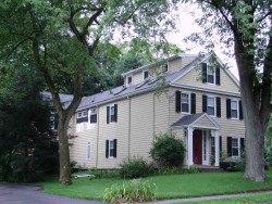
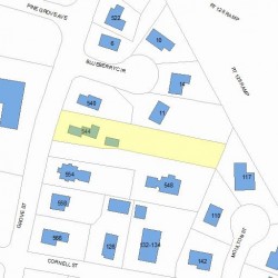
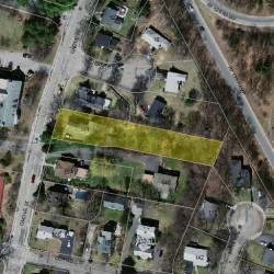
544 Grove St Newton, MA 02462-1429
Visit 544 Grove St in Newton, MA, 02462-1429
This profile includes property assessor report information, real estate records and a complete residency history.
We have include the current owner’s name and phone number to help you find the right person and learn more.
PROPERTY OVERVIEW
Type: Single Family
4 beds2 baths5,589 sqft
4 beds2 baths5,589 sqft
Facts
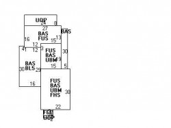
Built in 1835Foundation type: Brick/Fldstone Property use: Single FamilyRoof type: Gable Lot size: 23,622 sqftRoof material: Asphalt Shingl Effective area: 5,259 sqftHeat type: Forced Air-Duc Gross building area: 5,589 sqftFuel type: Gas Building type: ResidentialAir conditioning: Central Rooms: 10Frontage: 64 feet Bedrooms: 4Basement area: 1,413 sqft Stories: 2Finished basement area: 468 sqft Exterior condition: AveragePorch area: 206 sqft Exterior walls: Wood ShingleEnclosed porch area: 28 sqft Trim: NoneDetached garage area: 450 sqft
Features
Kitchen quality: Above AverageInterior condition: Good
Recent residents
| Resident Name | Phone | More Info |
|---|---|---|
| Joel L Sisenwine, age 58 | (617) 527-5803 | Status: Last owner (from May 30, 2000 to now) Occupation: Religious Education: Graduate or professional degree Email: |
| Heidi J Sisenwine, age 57 | (617) 527-5803 | Status: Last owner (from May 30, 2000 to now) Occupation: Protective Service Occupations Email: |
| Susan R Daylor, age 74 | (617) 965-7901 | Status: Previous owner (from Feb 15, 1995 to May 30, 2000) |
| R Daylor | (617) 965-7901 | |
| Robert F Daylor, age 87 | (617) 965-7901 | |
| Susan R Morison | Status: Previous owner (from Jul 09, 1991 to May 30, 2000) |
|
| Robert F Morison Jr | Status: Previous owner (to Jul 09, 1991) |
|
| Rosalie A Daylor | ||
| Talia M Sisenwine, age 27 | (617) 527-5809 | Status: Renter |
Business records related to this address
| Organization | Phone | More Info |
|---|---|---|
| Joel Sisenwine Rabbi | Industry: Religious Organization |
Neighbors
Real estate transaction history
| Date | Event | Price | Source | Agents |
|---|---|---|---|---|
| 05/30/2000 | Sold | $645,000 | Public records |
Assessment history
| Year | Tax | Assessment | Market |
|---|---|---|---|
| 2016 | $1,062,000.00 | ||
| 2015 | $992,500.00 | ||
| 2014 | $930,200.00 | ||
| 2013 | $930,200.00 | ||
| 2012 | $930,200.00 | ||
| 2011 | $905,200.00 | ||
| 2010 | $923,700.00 | ||
| 2009 | $837,300.00 | ||
| 2008 | $837,300.00 | ||
| 2007 | $783,800.00 | ||
| 2006 | $761,000.00 | ||
| 2005 | $711,200.00 | ||
| 2004 | $647,700.00 | ||
| 2003 | $578,300.00 | ||
| 2002 | $578,300.00 | ||
| 2001 | $501,600.00 | ||
| 2000 | $458,100.00 | ||
| 1999 | $416,800.00 | ||
| 1998 | $352,500.00 | ||
| 1997 | $332,500.00 | ||
| 1996 | $278,700.00 | ||
| 1995 | $266,600.00 | ||
| 1994 | $253,900.00 | ||
| 1993 | $253,900.00 | ||
| 1992 | $281,300.00 |
Incidents registered in Federal Emergency Management Agency
17 Jul 2003
Unintentional transmission of alarm, other
Property Use: 1 or 2 family dwelling
Actions Taken: Investigate
Actions Taken: Investigate