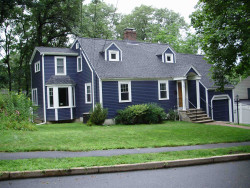
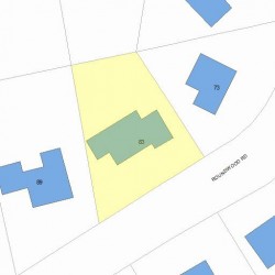
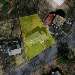
83 Roundwood Rd Newton, MA 02464-1218
Visit 83 Roundwood Rd in Newton, MA, 02464-1218
This profile includes property assessor report information, real estate records and a complete residency history.
We have include the current owner’s name and phone number to help you find the right person and learn more.
Building Permits
Jul 11, 2011
Description: Remove and replace driveway-same footprint
- Valuation: $510,000
- Fee: $93.00 paid to City of Newton, Massachusetts
- Parcel #: 51014 0008
- Permit #: 11070214
Apr 2, 2010
Description: Replace existing deck/stairs with new deck/stairs
- Contractor: Signature Decks
- Valuation: $900,000
- Fee: $167.40 paid to City of Newton, Massachusetts
- Parcel #: 51014 0008
- Permit #: 10040051
PROPERTY OVERVIEW
Type: Single Family
3 beds3.5 baths3,140 sqft
3 beds3.5 baths3,140 sqft
Facts
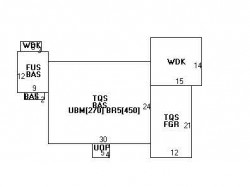
Built in 1940Foundation type: Concrete Property use: Single FamilyRoof type: Gable Lot size: 7,100 sqftRoof material: Asphalt Shingl Effective area: 2,897 sqftHeat type: Steam Gross building area: 3,140 sqftFuel type: Oil Building type: ResidentialAir conditioning: Central Rooms: 7Frontage: 95 feet Bedrooms: 3Basement area: 720 sqft Stories: 1.75Finished basement area: 450 sqft Exterior condition: GoodPorch area: 20 sqft Exterior walls: ClapboardDeck area: 228 sqft Trim: NoneAttached garage area: 252 sqft
Features
Kitchen quality: Above AverageBath quality: Average
Recent residents
| Resident Name | Phone | More Info |
|---|---|---|
| Carl S Katz, age 56 | (617) 332-6699 | Status: Last owner (from Sep 30, 2003 to now) |
| Leah B Oko, age 64 | (617) 332-6699 | Status: Last owner (from Sep 30, 2003 to now) |
| Leah Katz | (617) 332-6699 | |
| Clare M Sullivan, age 60 | (617) 964-8589 | Status: Previous owner (to Sep 30, 2003) Occupation: Sales Occupations |
| Clare M Freeman | Status: Previous owner (from Sep 15, 1995 to Sep 30, 2003) |
|
| Joseph R Roy | Status: Previous owner (to Sep 15, 1995) |
Neighbors
Real estate transaction history
| Date | Event | Price | Source | Agents |
|---|---|---|---|---|
| 09/30/2003 | Sold | $545,450 | Public records |
Assessment history
| Year | Tax | Assessment | Market |
|---|---|---|---|
| 2016 | $620,000.00 | ||
| 2015 | $579,400.00 | ||
| 2014 | $548,400.00 | ||
| 2013 | $548,400.00 | ||
| 2012 | $548,400.00 | ||
| 2011 | $554,700.00 | ||
| 2010 | $566,000.00 | ||
| 2009 | $577,500.00 | ||
| 2008 | $552,900.00 | ||
| 2007 | $556,700.00 | ||
| 2006 | $540,500.00 | ||
| 2005 | $514,800.00 | ||
| 2004 | $385,500.00 | ||
| 2003 | $344,200.00 | ||
| 2002 | $344,200.00 | ||
| 2001 | $291,600.00 | ||
| 2000 | $266,300.00 | ||
| 1999 | $242,300.00 | ||
| 1998 | $222,900.00 | ||
| 1997 | $214,300.00 | ||
| 1996 | $214,300.00 | ||
| 1995 | $182,800.00 | ||
| 1994 | $182,800.00 | ||
| 1993 | $182,800.00 | ||
| 1992 | $211,600.00 |
Incidents registered in Federal Emergency Management Agency
17 Jan 2011
Carbon monoxide incident
Property Use: 1 or 2 family dwelling
Actions Taken: Investigate
Actions Taken: Investigate


